


Boucle MANDALLAZ

Jean-Paulchoux
User
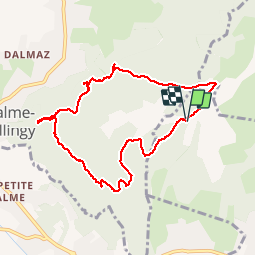

Length
8.5 km

Max alt
896 m

Uphill gradient
378 m
Km-Effort
13.6 km

Min alt
638 m

Downhill gradient
380 m
Boucle
Yes
Creation date :
2019-05-30 08:13:26.463
Updated on :
2019-05-30 14:16:16.085
2h41
Difficulty : Easy

FREE GPS app for hiking
 SityTrail
IGN / Geographical institutes
SityTrail Plus
The world is yours!
About
Trail Walking of 8.5 km to be discovered at Auvergne-Rhône-Alpes, Upper Savoy, Épagny Metz-Tessy. This trail is proposed by Jean-Paulchoux.
Description
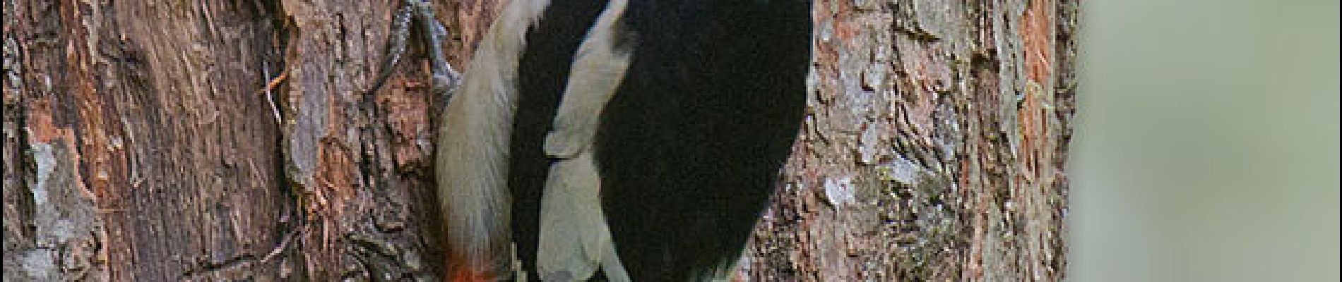
Avec un plus : j'ai assisté au nourrissage des bébés pic épeiche….!
Photos


Positioning
Country:
France
Region :
Auvergne-Rhône-Alpes
Department/Province :
Upper Savoy
Municipality :
Épagny Metz-Tessy
Location:
Unknown
Start:(Dec)
Start:(UTM)
273208 ; 5093802 (32T) N.
Comments